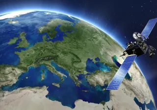
Is a mountain wall sliding down into a village? What direction will a forest fire or flood take? How extensive a flight ban would be needed in the event of a volcanic eruption? Answers to these questions are often found in remote sensing data collected by satellites.
Many people probably follow the cloud radar stationed in their surrounding environment, and we have also become familiar with images of hurricane whirlwinds. These are examples of continuous remote sensing conducted through the processing of images taken by satellites and then utilising them in forecasts.
Hurricane forecasts make it easier to prepare for them, but satellite images can also be used when a storm has already made landfall or a volcano has erupted. Images help to determine the extent of damage and to plan rescue work. Satellite images show, for example, the locations of flooded areas or provide tips on the impact of ash clouds on air travel.
Measuring the amount of dry forest - that is - fuel
Could remote sensing even be used to prevent natural disasters? It would be great to be able to answer “yes” to this question, but as we are cautious researchers, we are content to note that remote sensing can at least be used to mitigate the effects of accidents. Take a forest fire, for example.
The state of forests is monitored with quite common satellites which provide both optical and radar images. Optical images are generated when satellites on orbit around the Earth measure how the Earth reflects solar radiation at each point. A standard digital camera separates visible light into three wavelength areas, red, blue and green, while many the instrument on many satellites divide light into narrower bands and also register infrared radiation. A satellite itself can also transmit electromagnetic radiation and measure how it is reflected or scattered off an object. This is how radars work.
Satellite images can be used to identify the main species of trees, the drying of forests and roads between forest stands. Combining this information with weather data gives us a fairly good idea of the risk of forest fires. The industry is talking about the mapping of the amount and location of fuel. This information is particularly important when a forest is already burning and it is necessary to assess where the fire is spreading and where rescue efforts should be directed.
In principle, a remote sensing application could provide the first alert of forest fires, but, in practice, satellites are seldom present at the right place at the right time. The delay may amount to several hours if only a few satellites are used. In densely populated California, people will certainly detect fires faster than satellites, but automatic alarms sent directly to Finnish and Canadian authorities also have a role to play.
Satellite can also see into poor countries
Radar equipment stationed on a mounting slope or in a valley monitoring an opposite mountain slope sliding slowly down is also a form of remote sensing. Timely and accurate information helps evacuate the village as the rate of the downward slide of the slope accelerates. Only It is very expensive to set up radar equipment on the slopes of thousands of mountains. This is why satellites are also used to monitor landslides. What they lose in accuracy and measurement frequency they gain in their ability to see into poor countries.
In the case of a major natural disaster, it is important that a great number of satellites can be quickly accessed for images and that applications can process the information contained in such images. This requires that data is comparable and that the processing of the data is as automated as possible. The developers of measurements and applications still have a great deal of work to do.
Our own work at VTT is largely related to the remote sensing of forests, which is increasingly linked to the biggest natural disaster of our planet - climate change. We are developing models that enable us to assess how much carbon forests around the world bind today and in the future. We can also assess how much carbon dioxide and other harmful substances are released by forest fires. We have built a cloud service called the Forestry Thematic Exploitation Platform Forestry TEP where researchers and service developers can access this information, at this point, free of charge.


